
If you want flat, run the Five Weirs Walk or the Sheffield & Tinsley canal towpath. If you want scenery with less effort, Damflask Reservoir’s 5.2 km loop is the pick. For a proper hill challenge, head from Ecclesall Woods towards Stanage Edge, and for after-dark miles, stick to the lit canal towpaths or Endcliffe Park. Every one of these has a downloadable map, so there’s no excuse for guessing your way round.
TL;DR:
- Most Sheffield routes are accessible by public transport, with tram and train services connecting key starting points like Meadowhall and city centre trails.
- Reservoir and canal towpath loops are the flattest options, suitable for recovery runs and long-distance mileage, with Damflask Reservoir as the best for scenic, flat off-road running.
- Trails such as Rivelin Valley and Redmires offer varied terrain, while Ecclesall Woods to Stanage Edge presents a significant hill challenge for experienced runners.
- Official signposted routes provide reliable navigation, with distances from under 1 km urban loops to 24 km moorland adventures, helping runners target their goals.
- Facilities vary by location, with some reservoirs and parks offering toilets and cafes, but moorland routes like Stanage Edge require carrying water and planning ahead.
Sheffield has more genuinely varied running terrain within city limits than most places twice its size, and that’s largely due to geography rather than planning. You’ve got moorland on one side, reservoirs stitched through the valleys, and a flat industrial corridor running straight through the middle of town. That mix means the question isn’t really “where can I run in Sheffield” but “what kind of run do I want today.”
The city also has an unusual amount of official route mapping. The Outdoor City run route guide lists more than 30 signposted routes across roughly 15 locations, colour-coded by difficulty, with distances ranging from a 355-metre urban loop right up to a 24 km moorland outing. That’s rare. Most cities leave you stitching together a route on Strava; Sheffield hands you a PDF.
Sheffield jogging routes tend to fall into four camps: flat urban corridors, reservoir loops, woodland trails, and proper moorland challenges. Knowing which camp you’re in before you lace up saves you from turning an easy recovery jog into an accidental hill session, or vice versa.
Damflask suits anyone who wants scenery without a training plan behind it. The Ecclesall to Stanage route is for runners who already have a long run in their legs and want a landscape to match. If you’re brand new to running in Sheffield, start with Crookes Valley Park or a short loop of Greno Woods before you commit to anything with “moorland” in the description.
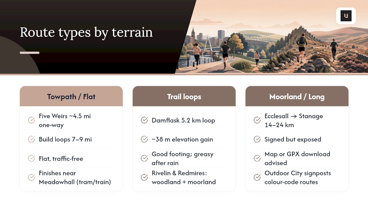
Five Weirs Walk and the Sheffield & Tinsley canal towpath form the backbone of flat running in Sheffield. The Five Weirs section runs about 4.5 miles one-way, and combined with the canal towpath you can build an out-and-back or loop of roughly 7 to 9 miles. The surface is flat and largely traffic-free, weaving past old steelworks and riverside sections, and Komoot’s route profile shows it finishing near Meadowhall, where tram and train links make the return leg painless if your legs have had enough.
Damflask Reservoir gives you a 5.2 km loop with about 38 metres of elevation gain, which is about as close to flat as off-road running gets around here. Footing is generally good, though it turns greasy after heavy rain, so it’s worth checking conditions if you’ve had a wet week.
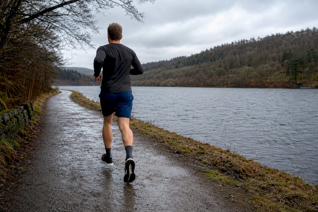
Rivelin and Redmires offer more textured trail running, with woodland sections and open moorland fringes. Elevation and profile data for these loops is available through AllTrails and Komoot, both of which are worth bookmarking if you like knowing exactly what a climb looks like before you hit it.
Ecclesall Woods to Stanage Edge is where things get serious. Routes from the Ecclesall Discovery Centre out to Stanage run 14 to 24 km and are signed but exposed, so a map or GPX download is sensible rather than optional.
Outdoor City’s colour-coded signposts are the single most useful tool for planning ahead. Routes are grouped from short urban loops up to full moorland days, so you can build fitness in stages rather than jumping straight to the hardest option on the list.
Trail surfaces vary constantly underfoot, and that’s not a downside. Whitehouse Clinic notes that varied-terrain running builds stability and reduces repetitive-stress injury risk compared with training exclusively on roads, which is one good reason to alternate towpath sessions with trail days rather than sticking to one surface all winter.
The table below draws on public ratings and route type to help you weigh up where to run next.
| Location | Type | Best for | Google reviews |
|---|---|---|---|
| UNIT health & performance | Gym / training | Coached conditioning and speed work to support route training | 5★ (37) |
| Ladybower Reservoir | Reservoir | Long scenic loops and lake-side views | 4.8★ |
| Wyming Brook Nature Reserve | Woodland reserve | Woodland trail runs and wildlife spotting | 4.8★ (976) |
| Crookes Valley Park | Urban park | Short easy runs and family outings | 4.7★ (714) |
| Langsett Reservoir | Reservoir | Long reservoir loops and quieter runs | 4.8★ (454) |
| Ecclesall Woods | Woodland | Technical woodland routes and access to Stanage | 4.8★ (452) |
| Lady Canning’s Plantation Mtb Trail | Trail | Mixed-terrain trail running | 4.7★ (472) |
| Forge Dam | Park / dam | Easy woodland loops close to the city | 4.6★ (333) |
| Damflask Reservoir | Reservoir | Flat 5.2 km scenic loop and recovery runs | 4.7★ (310) |
| Rivelin Reservoir | Reservoir | Scenic valley running near woodland trails | 4.7★ (323) |
| Accelerate Uk | Running shop / club | Kit, advice and local running community | 4.8★ (243) |
| Owler Tor | Moorland viewpoint | Elevated moorland running with views | 4.8★ (223) |
| Greno Woods | Woodland | Short trail runs and family loops | 4.7★ (187) |
| Agden Reservoir | Reservoir | Quiet reservoir loops away from crowds | 4.7★ (103) |
| Rivelin Valley Trail | Trail | Varied woodland and riverside trail running | 4.8★ (61) |
| Five Weirs Walk | Urban corridor | Flat long runs and commute-style training | 4.4★ (61) |
| Porter Brook Trail - Endcliffe Park | Park trail | Easy scenic loops near the city centre | 4.9★ (24) |
| Upper Don Trail - Sheffield City Centre | Urban trail | City-centre running with river views | 5★ (2) |
A gym offering coached conditioning complements running routes by providing structured training alongside mileage, adding benefits that natural routes alone do not.
Before you head out, run through a short checklist: how far do you want to go, what surface suits your shoes, are you after hills or flat effort, will you finish in daylight, and where are you parking or getting the bus from.
Pro Tip: After a wet week, swap any woodland trail session for a reservoir loop like Damflask or Agden. The paths around reservoirs drain faster than forest tracks, so you get a cleaner run without the mud sapping your pace.
Mobility work matters just as much as route choice, particularly if you’re mixing flat road miles with uneven trail days. A few minutes of hip mobility routines before a trail session can make the transition between surfaces far less jarring on your hips and knees.
Route variety only gets you so far without conditioning behind it. Some gyms offer small-group personal training focused on strength and speed work, which pairs well with local running routes to help address muscular strength and hill resilience.
The gym also runs youth athlete programmes focused on speed, agility and power, useful if your children are running for a school or club and need more than just distance work. Pairing structured small-group personal training with regular route running is how a lot of local runners turn steady mileage into visible fitness gains rather than just tired legs.
Ladybower Reservoir has a visitor centre with toilets and a café near the dam, useful if you’re doing a longer loop and want a natural halfway stop. Crookes Valley Park sits close to several cafés on Crookesmoor Road, which makes it a sensible spot for a post-run coffee without much of a detour.
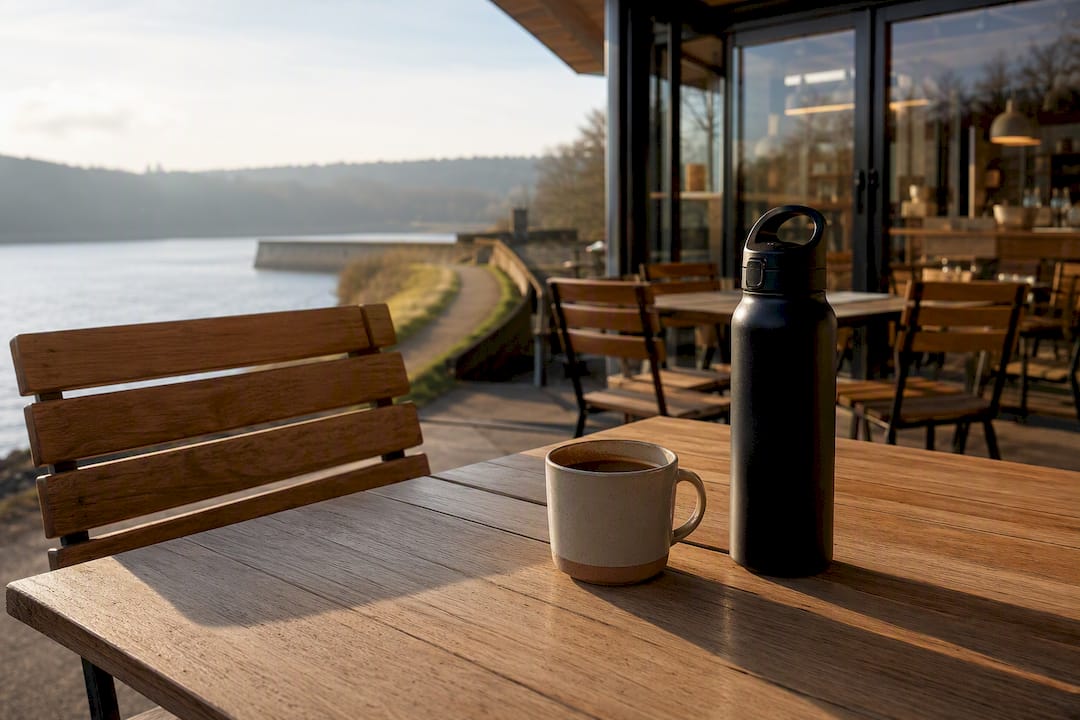
Forge Dam has a small café right by the water, popular with families and dog walkers as much as runners, so expect it busy on weekend mornings. Damflask and Agden reservoirs are quieter on facilities: there are no on-site toilets or cafés directly on the loop, so plan ahead or treat it as a shorter, self-contained run.
Along the Five Weirs Walk and canal towpath, amenities are patchy in the middle sections but improve towards both ends, with cafés near the city centre start point and shops around Meadowhall at the far end. Ecclesall Woods has a discovery centre with toilets, though once you head towards Stanage Edge, facilities disappear entirely, so carry water if you’re doing the full distance.
Sheffield’s tram and train network makes several of these routes genuinely easy to reach without driving. The Supertram Blue and Yellow lines run close to the city centre end of the Five Weirs Walk, and regular trains from Sheffield station to Meadowhall mean you can run one-way and catch a train back rather than doubling the distance.
Buses reach most of the woodland and reservoir routes reasonably well. Services running out towards Hillsborough and Stannington get you within walking distance of Rivelin Valley Trail and Rivelin Reservoir, while routes towards Millhouses put you close to Ecclesall Woods. Langsett and Damflask reservoirs sit further out towards the Peak District fringe, and public transport there thins out considerably, so a car or a lift is the more realistic option for those two.
For anyone running the Upper Don Trail through the city centre, it’s about as accessible as it gets: most tram stops and the train station sit within a short walk of the route.
Ladybower Reservoir has several pay-and-display car parks, and they fill up quickly on weekends, particularly in summer, so an early start helps if you want a space near the dam. Damflask Reservoir has a smaller free car park, but space is limited and it empties fast on sunny mornings.
Ecclesall Woods offers free parking at the discovery centre, though it’s modest in size and best avoided at peak weekend times. Rivelin Valley and Forge Dam both have small free car parks that fill early on dry weekends, so if you’re planning a Saturday morning trail run, arriving before 9am is a sensible habit.
City-centre routes like the Upper Don Trail and Porter Brook Trail near Endcliffe Park benefit from nearby pay-and-display parking and multi-storey options, generally more expensive but far more reliably available than the free countryside car parks. If you’re driving out to Langsett or Agden reservoirs, expect free roadside or informal parking, but arrive early on any weekend with good weather.
For a weekday flat commute run, the Five Weirs Walk is hard to beat. For a weekend scenic loop, Damflask Reservoir rewards minimal effort with genuine views. In winter, stick to lit paths and check daylight hours before heading to moorland routes; in summer, an early start beats fighting the heat on exposed trails.
— Vitalij
Route variety gets you fit up to a point, but most runners plateau without structured strength and conditioning behind the mileage. Some local gyms offer small-group coaching focusing on strength, speed, and hill resilience for runners, along with tailored programmes for youth athletes, providing guided training without the cost of private sessions.

If you’re serious about turning Sheffield’s routes into real fitness gains, the next step is straightforward: book a taster session through Small Group PT and see how coached conditioning changes the way you run.
The Five Weirs Walk for flat mileage, Damflask Reservoir for an easy scenic loop, and the Ecclesall Woods to Stanage Edge route for a proper hill challenge cover the main bases.
Sheffield doesn’t have many formal athletics tracks for public use, but for off-road running, Ladybower Reservoir, Rivelin Valley Trail, and the Outdoor City signposted routes offer the best mapped surfaces.
Google Maps can plot walking or cycling directions you can adapt for running, but it won’t give you elevation profiles or trail-specific data. Komoot and AllTrails are better suited to that, and the Outdoor City PDF guide covers Sheffield-specific signposted routes.
The Five Weirs Walk and the Sheffield & Tinsley canal towpath are the flattest long options, while Damflask Reservoir offers a shorter flat loop of about 5.2 km with minimal elevation change.